**With one day in Chongqing, stay around Jiefangbei, Shibati, Hongya Cave and one opposite-bank night view.** A second day is enough for Liziba, E'ling and a south-bank sunset; a third lets you add Ciqikou, the Three Gorges Museum or a slower neighbourhood route. Wulong and Dazu each need a separate day.
The list below is organised by route, not fame. Chongqing's steep peninsula, two rivers and different night-view banks make the order of the sights as important as the sights themselves.
## Choose by the time you actually have
| Time | Best use | Leave out |
|---|---|---|
| 1 day | Jiefangbei, Shibati, Hongya Cave and one opposite-bank view | Liziba, Ciqikou and distant day trips |
| 2 days | Add Liziba + E'ling, then Longmenhao or Nanbin Road | Wulong |
| 3 days | Add Ciqikou, Three Gorges Museum or a slower neighbourhood day | A rushed same-day Wulong return |
| 4+ days | Add Wulong or Dazu | Trying to combine both with a city evening |
## 1. Jiefangbei: the practical centre
The Liberation Monument stands at the most useful orientation point on the Yuzhong peninsula. Come for the first hour, not the whole day: save the Chinese name **解放碑**, identify your rail exits, then walk toward Shibati, Bayi food streets or the river edge.
## 2. Shibati: the cleanest descent through old and new Chongqing
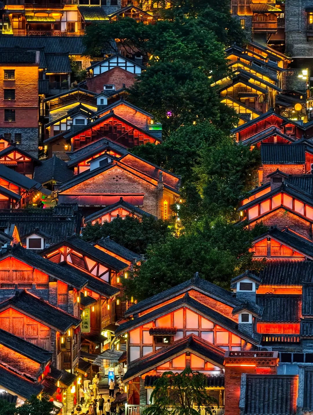
**Shibati (十八梯)** connects the upper city to lower streets through rebuilt lanes, stairs and courtyards. It is polished and busy, but it teaches the city's vertical structure better than a shopping mall viewpoint. Walk downhill when possible; reversing the route turns a gentle exploration into a workout.
## 3. Shancheng Trail: slower and more textured
Choose **Shancheng Trail (山城巷)** when you prefer retaining walls, old houses and hillside views over a heavily restored attraction. It works best in daylight and dry weather. Do not add it simply because it appears close to Shibati: both involve elevation and deserve time.
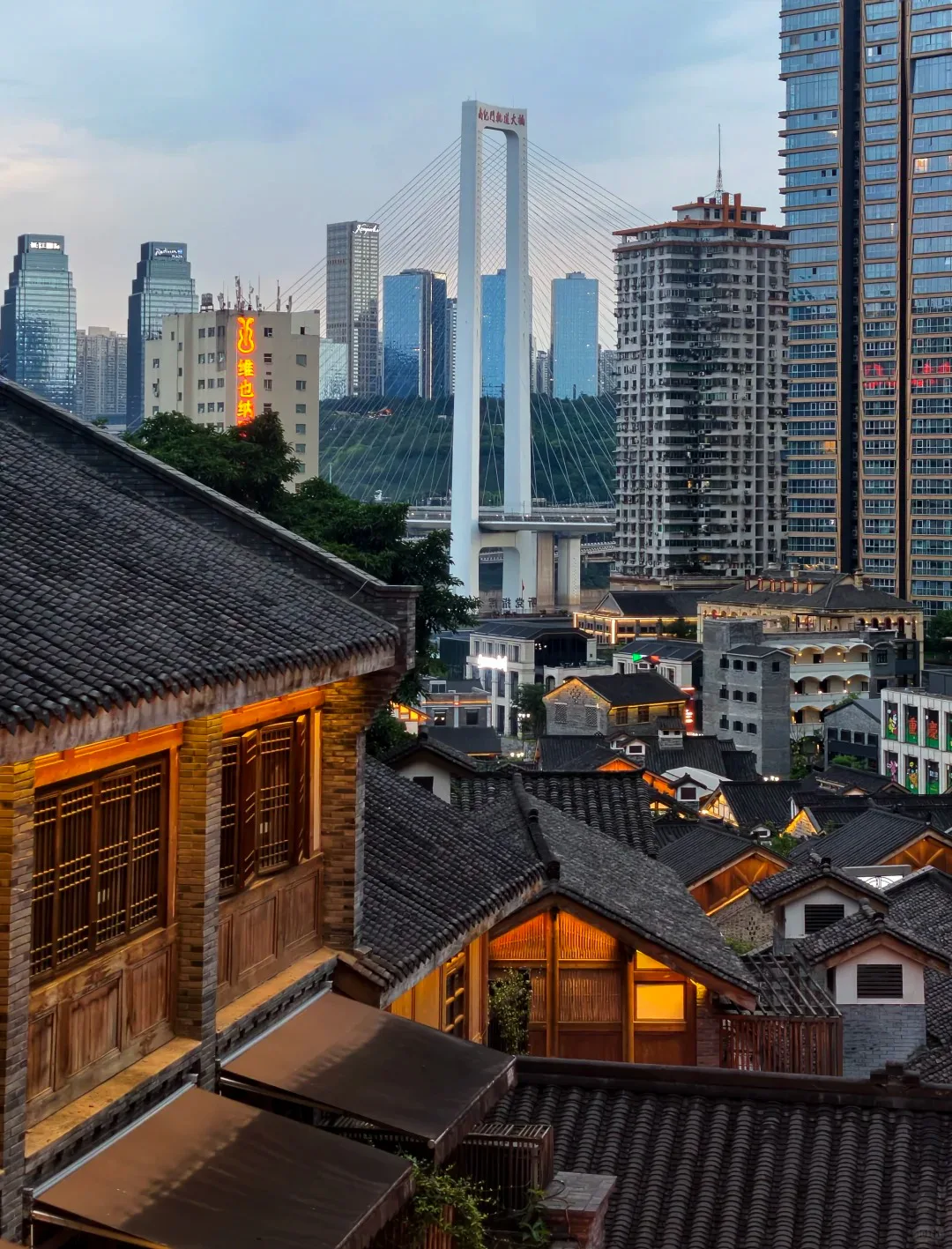
Shibati after dark: restored roofs and stairs show how tightly the lower city is stacked. Photo: 乌昂则.Old and new share one slope. The upper skyline appears behind the older roofs as the path changes level. Photo: 乌昂则.
## 4. Hongya Cave: see it from outside
Hongya Cave is at its strongest after the lights come on and from enough distance to see the full tiered facade. Walk through once if curious, but spend the valuable evening minutes on **Qiansimen Bridge** or the **Jiangbeizui / Grand Theatre riverfront**. Avoid stopping in the bridge's traffic flow or blocking the pedestrian path for a tripod shot.
## 5. Chaotianmen and Raffles City: where the rivers meet
Chaotianmen sits at the tip of the peninsula where the Yangtze and Jialing meet. The surrounding Raffles City complex is modern and large; use the river edge and external viewpoints to understand the geography rather than treating the mall as the destination.
## 6. Yangtze River Cableway: transport turned city view
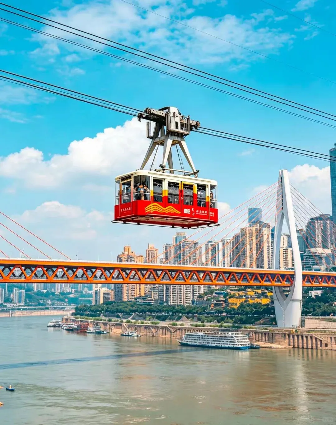
The **Yangtze River Cableway (长江索道)** is short, popular and weather-sensitive. It makes most sense when it carries you between the Yuzhong and Nan'an sides of a route you already planned. A long queue for a return ride is less useful than crossing once and continuing on foot or rail.
Use the cableway as a crossing. It becomes more satisfying when it advances the route instead of creating a separate out-and-back queue. Photo: 西西在搬砖.
## 7. Longmenhao Old Street: south-bank sunset
Longmenhao combines hillside lanes with views back toward the Yuzhong peninsula. Arrive before sunset so you can understand the paths in daylight, then watch the skyline turn on. It pairs naturally with the cableway or Nanbin Road.
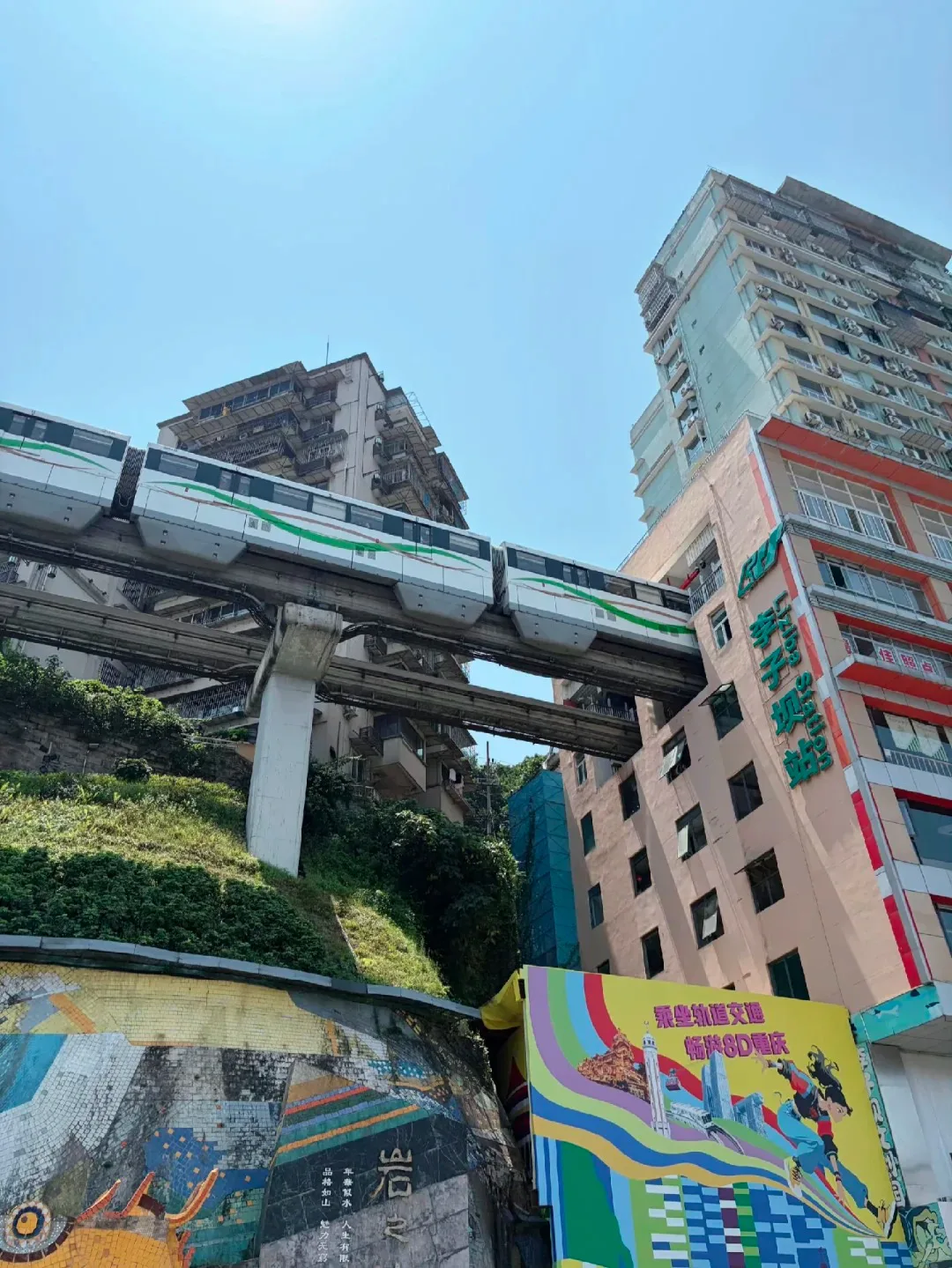
## 8. Liziba: the famous monorail stop
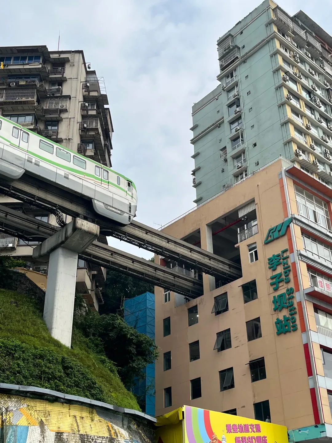
At **Liziba (李子坝)**, Line 2 passes through a residential building. The official viewing area makes the photo quick. The worthwhile half-day comes from continuing toward E'ling and seeing how rail, roads and housing occupy different levels.
The recognised Liziba view: the train disappears into the residential block above the street. Photo: 啊扣.(见过J-hope版).Step back for the infrastructure. The wider angle shows the track, building and street occupying separate levels. Photo: 旅游景点打工仔.
## 9. E'ling Park and Testbed 2
E'ling gives the west-central route a higher viewpoint; nearby Testbed 2 repurposes industrial buildings for studios, shops and cafés. Choose it for atmosphere and urban form, not because every storefront is essential.
## 10. Three Gorges Museum
The **Three Gorges Museum (重庆中国三峡博物馆)** provides context for regional history, the river and the dam project. It is a strong hot, rainy or hazy-day choice. Verify the current opening day and reservation process before visiting; many Chinese museums close on Mondays, but holiday arrangements can differ.
## 11. Ciqikou Ancient Town
Ciqikou is photogenic early and congested later. Use the first hour for the old streets, then leave the main commercial lane for quieter side alleys. If the itinerary already includes several restored old streets, the museum or a local neighbourhood may add more contrast.
## 12. Wulong: a separate landscape day
Wulong's Three Natural Bridges, Fairy Mountain and Furong Cave belong to the wider municipality, not the central-city circuit. The official Chongqing government overview places the tourism area **about 129 km from central Chongqing**. Choose one organised day or an overnight plan, check the actual transport and opening arrangements, and do not attach Hongya Cave to the same evening as if the return were guaranteed.
## What I would skip or shorten
- **A long interior loop at Hongya Cave:** the best view is outside.
- **Multiple restored old streets in one day:** choose Shibati, Longmenhao or Ciqikou for different route needs.
- **A river cruise solely for photos:** a bridge or riverbank can offer a steadier, cheaper composition; take a cruise only if you want the ride itself.
- **Baixiangju as a loud photo set:** it is residential. Keep groups small, stay out of doorways and leave when asked.
- **Wulong as a half-day:** the distance and scenic-area transfers make that unrealistic.
## Build the rest of the trip
Use the [Chongqing travel guide](/en/chongqing/) for a three-day sequence, the [interactive map](/en/chongqing/map/) for clusters and crossings, and the [Cyberpunk City China route](/en/chongqing/cyberpunk-city/) for the best evening order.
## Official references
- [Chongqing Municipal Government attraction directory](https://english.cq.gov.cn/aboutchongqing/)
- [Official Wulong — South China Karst overview](https://english.cq.gov.cn/aboutchongqing/culture/NaturalHeritage/202606/t20260612_15751145.html)
- [Chongqing Transport Commission rail network map (10 February 2026)](https://jtj.cq.gov.cn/zwgk_240/zfxxgkml/gggs/tzgg/202603/t20260302_15481715.html)